Article · Field note 20
Underwater mountains change the surrounding water
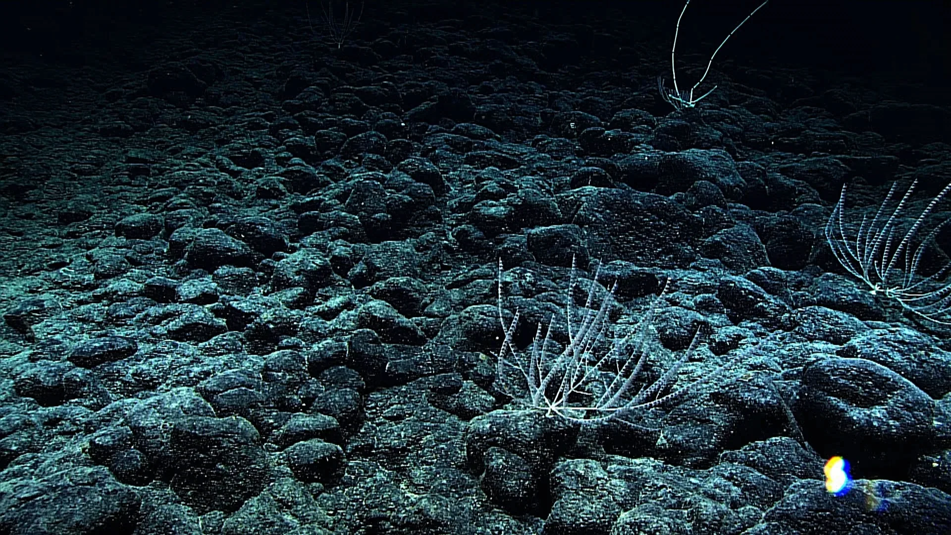
A seamount is a large underwater elevation rising from the seafloor. It can be volcanic in origin, but the term describes the feature’s shape rather than a single geological history. NOAA’s guide records Acanella weberi, a branching deep-sea coral, at 1,940 meters on Keoea Seamount in the Pacific. That pairing gives the article a specific anchor: a coral on a named mountain, at a measured depth. It does not make the coral a representative of every seamount community.
Relief changes how water moves. Currents can be deflected, accelerated, or split around a seamount; in some settings, circulation creates eddies and brings nutrient-rich water upward. These effects vary with the shape of the feature, the current, and the surrounding ocean. A seamount is not automatically a productive “oasis,” and its summit is not necessarily richer than every nearby slope. The physical setting creates opportunities for different habitats, while observations determine which organisms occupy them.
A place for attached animals
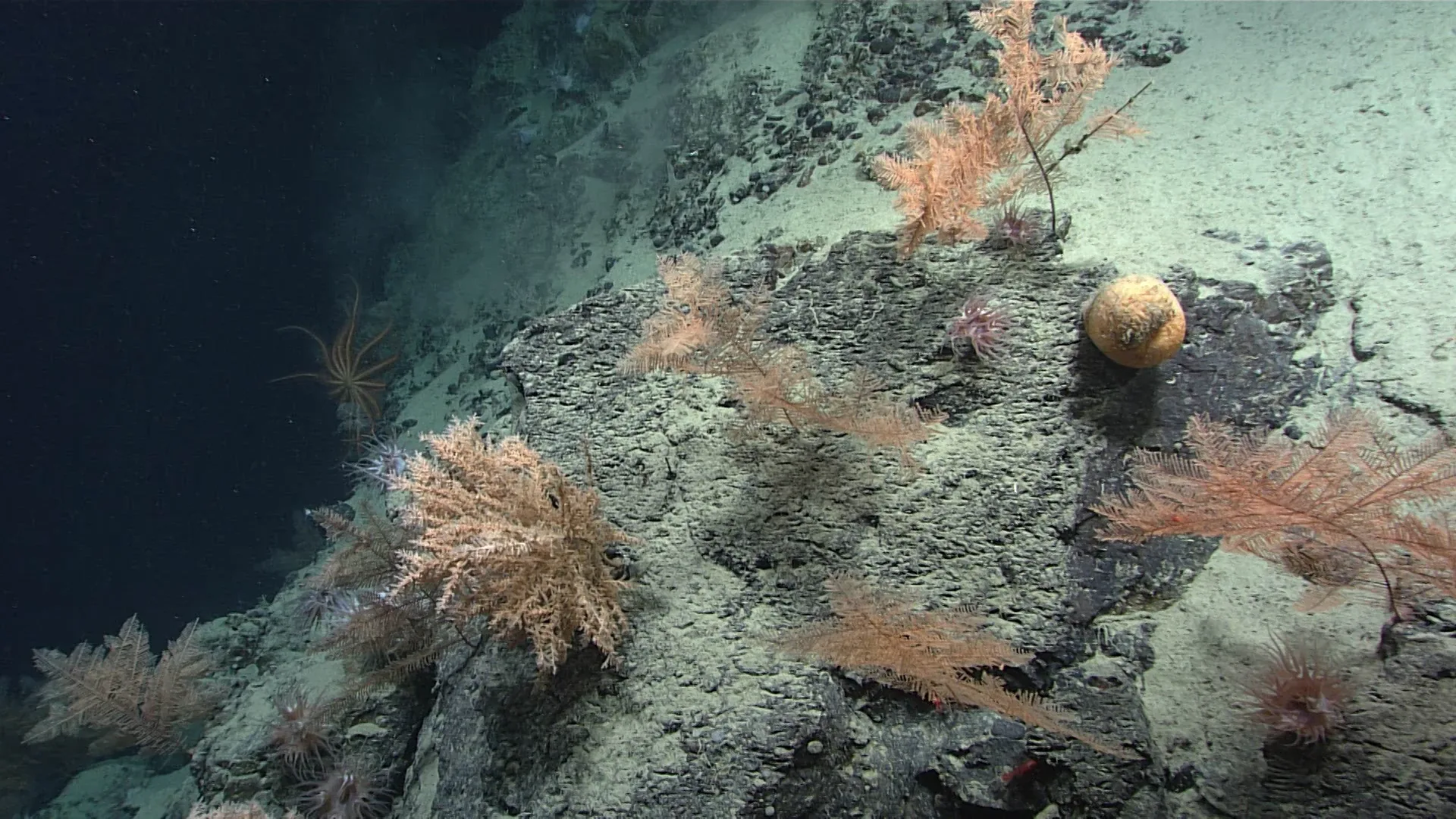
Many seamounts expose hard substrate where deep-water corals, sponges, and other suspension feeders can attach. The animals capture particles or small prey carried by current. Their forms can add further structure, turning a bare rock into a community of branches, stalks, and filtering surfaces. NOAA describes deep-sea corals and sponges across seamounts, canyons, shelves, and slopes; their habitat role is documented in many regions, though the species and densities vary.
The Acanella weberi record is a useful reminder that “coral” is a broad category. This coral’s image shows a branching colony on the seamount, but not its full size or age. The camera frame can crop the base and surrounding terrain. A survey would map the colony, its neighbors, and the local substrate. Without that wider view, a single image should not be used to describe the whole seamount as a coral garden.
Seamounts can support different communities at different depths. Light, pressure, temperature, oxygen, and food change from the summit down the flanks. A species on a shallow shoulder may not occur at the base; a current exposed ridge may support different organisms from a sedimented depression nearby. The feature is three-dimensional, so its habitat cannot be summarized with only one depth or one photograph.
Are seamounts biological islands?
Seamounts are sometimes compared to islands because they rise from a deeper plain and can host localized communities. The analogy is useful when it highlights separation and hard habitat. It can mislead if readers assume that each seamount contains unique species or is completely isolated. Currents connect seamounts, larvae can disperse, and some mobile animals travel between features. Connectivity depends on species and life history.
To know whether two seamount populations exchange individuals, researchers compare genetics, larval biology, and distribution. Two colonies that look similar in video may belong to different species or populations; two sites separated by distance may share larvae. A map of coral observations can suggest patterns but cannot prove connectivity. Genetic sampling and repeat surveys add evidence that a camera image alone cannot supply.
Currents, food, and vertical relief
When currents meet a mountain, they may lift and redirect water. In some places, this can transport nutrients toward sunlit layers and support plankton growth. At depth, the same circulation can move particles past suspension feeders. The path of the current matters: an animal on an exposed ridge may encounter more flow than one sheltered behind a rock. The relationship between relief and food is therefore local, not a universal promise of increased productivity.
Corals and sponges can create a secondary layer of structure on the seamount. Fish and invertebrates may use branches as shelter or feeding sites, and the colony itself becomes part of the habitat. NOAA’s Northeast Canyons and Seamounts description notes that deep coral communities and other structure-forming fauna can provide food, spawning habitat, and shelter. That broad role is a guide to what ecologists measure, not a guarantee that every photographed coral has every function.
A record does not define the mountain
The NOAA image of Acanella weberi at Keoea Seamount is a single observation. It tells us the identification assigned to the animal, the locality, and the depth. It does not reveal the total number of colonies, whether the seamount is densely covered, or how current changed during the dive. These questions require mapping and repeated sampling.
Seamount communities are compelling because geology, current, and biology meet in one place. The underwater mountain changes flow; flow delivers particles and shapes where animals can attach; colonies create further habitat. But each step depends on local conditions. The strongest description starts with a named feature and a documented encounter, then tests wider claims through physical oceanography and biological surveys. The coral on Keoea Seamount is a real point in that story, not a shortcut to conclusions about every underwater mountain.
A useful seamount comparison separates exposed rock from current exposure. Rock provides an attachment surface; flowing water supplies suspended food. Either condition can occur without the other being favorable. Mapping both variables explains why neighboring elevations may support different communities, and why simply classifying every rise as a biodiversity hotspot would hide the environmental mechanisms a survey needs to measure.