Article · Field note 17
A crab of the Atlantic continental slope
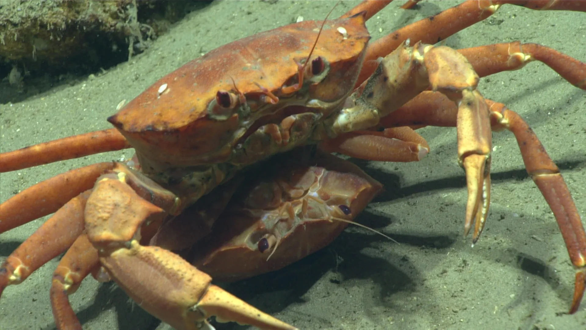
The Atlantic deep-sea red crab, Chaceon quinquedens, occupies deep habitats along the western North Atlantic margin. NOAA Fisheries describes its range from Nova Scotia toward North Carolina and into the Gulf of Mexico, at roughly 200 to 1,800 meters. The cover image records the species at 740 meters in an unnamed North Atlantic canyon. Its source is expedition EX1905L2, dive 5, in September 2019. An earlier version of this article incorrectly placed that observation in Alaska; the underlying photograph and metadata are Atlantic.
The correction matters because a geographic error can create a false biological puzzle. There is no need to invent an unexplained Pacific population or speculate that the archive contains the wrong species when the source record already identifies an Atlantic locality. The useful story is how a mobile crab uses a deep continental margin, and how researchers learn about that population through methods ranging from camera observations to commercial fishing records.
A slope contains more than one bottom type
NOAA's species account places red crabs on smooth silty bottom as well as rocky canyons. These surfaces differ in shelter, sediment stability, and the way food accumulates. A depth contour alone cannot show those differences. Two observations made at 740 meters might come from an open sediment field and a steep canyon wall. Describing the terrain therefore adds ecological information that would disappear in a distribution map containing only dots and depths.
The crab's legs permit movement across the bottom, while its claws handle food and interact with its surroundings. These visible structures make it reasonable to ask about feeding and movement, but not to assign a complete diet from a still. A crab near carrion could be feeding, approaching, or passing through. Direct footage and specimen-based diet studies answer different parts of that question. The animal's capacity to move also means that a census at one time need not represent permanent occupancy of that patch.
What a pot samples
The directed fishery uses pots. A baited pot samples animals that encounter its odor field, approach the gear, enter it, and remain until retrieval. That chain is more selective than collecting everything within a fixed circle. Currents move odor through the water, while crab size, activity, and the design of the opening influence entry and retention. These are general properties of baited sampling that explain why a catch cannot be interpreted as an unbiased photograph of the surrounding population.
An ROV transect has a different filter. It detects crabs within a camera's field of view along a chosen route, including individuals that may never enter a pot. Terrain can conceal animals; vehicle altitude and image quality influence which sizes are visible. Comparing pot catches with video can therefore be informative precisely because the methods do not measure identical things. Agreement increases confidence in a pattern, while disagreement can reveal differences in behavior or detectability rather than an error in either instrument.
Landings are a dated measurement
NOAA reports 2.1 million pounds of United States commercial red-crab landings in 2024. That number describes a reporting year and a fishery. It is not the amount of crab living on the Atlantic slope, a global harvest estimate, or evidence that abundance increased. Landings depend on effort, demand, regulations, and catchability as well as the stock itself. A responsible comparison needs the same measurement through time, with the relevant changes in fishing practice and management included.
The fishery's permit and gear requirements also belong to a management system rather than the animal's natural history. They shape which vessels can fish and how fishing occurs. A species profile can explain this connection without presenting management status as proof that every local habitat is undamaged. Fishery productivity, the condition of benthic communities, and the abundance of one photographed crab are separate quantities. Each needs an appropriate survey and a defined geographic scale.
Distinguishing a population from an encounter
A population assessment asks how many animals are present, how they grow, and how reproduction and mortality change their numbers. A photograph supplies a much narrower observation. Repeated, standardized camera routes could compare crab density between canyon and open-slope habitats. Measuring body sizes would require a calibrated scale, and identifying reproductive condition might require collected animals. Combining those measurements is more useful than treating a visually large individual as evidence of a healthy or unusually old population.
The 740-meter encounter contributes a traceable point within the known Atlantic setting. It can be revisited alongside nearby dive footage to examine substrate and other animals. Its depth lies within NOAA's broad account, but that agreement does not make it representative of all occupied depths. A species found across a large vertical range encounters different temperatures, water masses, and food conditions. Regional surveys are needed before the pattern at one canyon can be extended along the margin.
A practical interpretation
The strongest reading of this red crab combines three scales: anatomy explains what the animal can do, habitat observations show where individuals occur, and fishery statistics describe a human activity affecting the population. None replaces the others. Keeping those scales distinct turns a bright crab in a canyon image into a useful account of deep-slope ecology and sampling. It also prevents a simple locality mistake from becoming an invented range extension or a prolonged controversy unsupported by the original record.